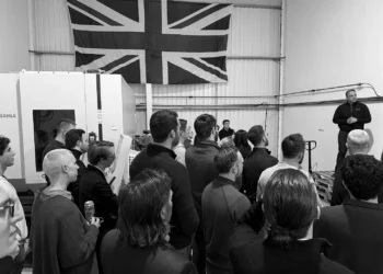
When SkySafe first told us what they were building it sounded like science fiction. The company, born out of MIT and the Air Force Research Lab, did early work on sensors, drones, and some of the first counter drone programs inside the U.S. Air Force. Their first customers were defense buyers, the Pentagon, and the Japanese military. That work taught them how to find, track, and stop small unmanned systems in the field.
The SkySafe platform can track drones can now track drones in real time using commercial drone hardware. For example, when you fly a DJI or similar drone, it transmits its location and telemetry constantly using a system called Remote ID or AeroScope. This data can be read by SkySafe receivers in various spots, including military installations and sports stadiums.
The result? A real-time view of all drone activity in an area.

SkySafe leases rooftop space across a metro area, sets up its own towers, and runs a passive RF sensor network that listens for drone traffic. The network ingests signals from any drone that is broadcasting location, ID, and pilot position. It builds a live picture of what is in the air, where it took off, who is flying it, and where it flew before. The company then sells that live picture as a subscription to the people who need it.
The customers are not just military. They also sell to airports, stadiums, prisons, border teams, universities, and local public safety.
“The key thing is providing that level of like awareness and safety,” said Grant Jordan, CEO. “Our customers kind of care about different pieces of this space. Airports care a lot about flight safety and not having to delay flights or halt flight operations because some Yahoo is flying a drone across runway.”
“I think one of the key things in all of this is that a lot of the focus and attention gets put on to malicious drones,” he said. “But to me, the big thing is we have to be able to have the infrastructure so that we can enable the good use of drones in these areas.”
In San Diego, where the company is based, they have full metro coverage down into Tijuana. On their internal map you can pull up the last seven days of drone flights and see alert zones for airports, bases, and other protected sites. Click on a flight and you get make, model, serial number, takeoff point, flight path, altitude, velocity, pilot location. You also get the full history of that airframe across the coverage area. If that same drone has been somewhere sensitive before, you can see the pattern.
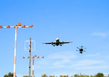
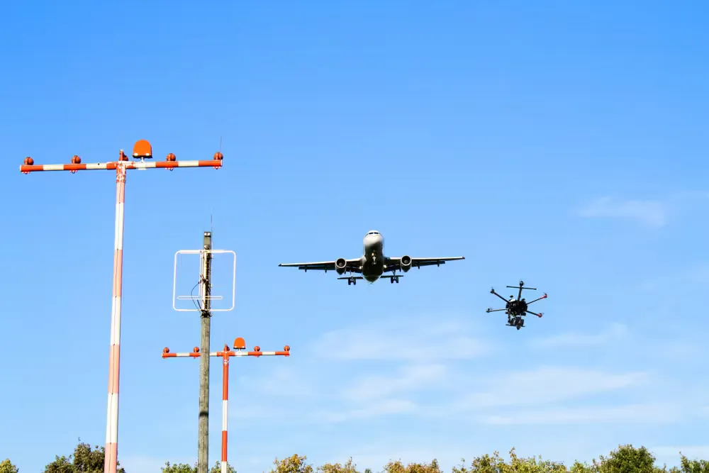
Conventional aviation functions because every aircraft is identifiable, monitored, recorded, and accountable to a shared standard. If a pilot violates controlled airspace, the Federal Aviation Administration can respond. Small unmanned aircraft have not operated under that level of discipline. The FAA has aimed for that outcome through its UAS Traffic Management concept, but one problem has remained unresolved. Who is responsible for collecting, interpreting, and distributing live positional data from these drones in a way that law enforcement, aviation authorities, and on-site security teams can actually use.
SkySafe is positioning itself as that layer of accountability.
When a drone enters a restricted area on SkySafe’s map, the system issues an alert in real time. The operator on site receives location data for both the drone and its pilot, which allows for an immediate response. In the prison context, that response usually has two steps. First, officers attempt to block the drop so contraband does not reach the inmate population. Second, they relay coordinates to local police, who can then walk directly to the pilot in the parking lot and make an arrest.
There is also a national security dimension, and SkySafe states this directly. The modern battlefield is saturated with drones. In Ukraine, off the shelf quadcopters are used for live targeting, intelligence and surveillance, and artillery adjustment. There are also custom built loitering weapons. There are modified first person view racing platforms used for direct strike. There are so called dark drones that do not broadcast any signal at all. There are tethered or fiber guided systems. No single sensing method can address every class of airborne threat.
SkySafe is focused on passive RF sensing and identity from drones that transmit. They position themselves as the base layer of wide area awareness. They know that in a live combat zone you still need radar, optical, jamming, interceptors, and lethal countermeasures. They are not trying to be every layer. They are trying to be the network feed for the class of threats that can be seen and tagged, so that other systems can stack on top.
“You’ve got a lot of different layers to that threat in the battlespace,” said Jordan. “You’ve got off the shelf drones being used for ISR and reconnaissance, guiding artillery and so on. You’ve got purpose built, weaponized drones. You’ve got dark drones that are not transmitting any information at all. You’ve got fiber optic drones. You have a lot of different types of threats in the battlespace, which honestly is not that different from how it’s always been.”
You have lots of different kinds of threats, artillery versus mortars versus rockets versus aircraft, and you have different systems and capabilities to track or counter each one. We focus on RF passive sensing. We’re looking at drones that are transmitting, drones that are giving off some signal. We’re not trying to cover every possible threat. What we’re trying to do is be that large scale foundational data provider for the types of drones we can track. Then our customers, our users, may need to supplement that with other tools, radar, cameras, or in the case of the military or federal government, mitigation systems to actually take drones down.”
Jordan described the government sales process in blunt terms. It is slow, political, and demanding. SkySafe does not claim otherwise. The company says it has already secured work with both the Department of Defense and the Department of Homeland Security. It has also expanded into public safety through a partnership with Motorola Solutions.
Motorola’s CommandCentral Aware platform is already deployed in many dispatch and security operations centers across the country. SkySafe’s data feed now runs inside that platform. In practice, that means agencies that already operate inside Motorola’s map can now see live drone activity on the same screen as their other sensor inputs.
SkySafe’s coverage currently spans roughly two dozen cities, with expansion under way toward twenty six. The company has raised just under fifty million dollars to date.
The notable change here is not only technical, it is structural. Ten years ago, counter drone usually meant a signal jammer in a hard case and a sales pitch built on fear. SkySafe is making a different claim. The company argues that you cannot have the future that industry keeps promising, drone delivery, inspection, perimeter security, and logistics at scale, unless you first build an air picture that every participant in that airspace can trust.
The position is simple: you do not get the legitimate use cases without controlling the illicit ones. You do not get control without common situational awareness. You do not get common situational awareness unless someone takes responsibility for the sensing layer.
That’s SkySafe’s job.